Photo essay
To mark the International Day of Action for Rivers on 14 March 2026, this photo essay flows through eight Southeast Asian rivers—each a ribbon of memory, livelihood, and life. Contributors from Laos, Myanmar, Thailand, Vietnam, and Indonesia revisit the waterways of their childhoods, tracing how communities and rivers have shaped one another. Through intimate portraits and sharp observations, the collection of photos reveals the fragile pulse of river ecosystems, the human forces reshaping them, and urgent snapshots of each river’s present-day condition.

Healthy river ecosystems are essential to maintain sustainable livelihoods of communities across the globe. They supply water for daily use and agriculture, nourish fisheries, sustain local food system, cultural heritage and traditions, and income generation.
Over the years, many rivers that were once abundant have been overused, heavily extracted, and degraded — effects made worse by climate change. Community access to water and natural resources is declining and increasingly complicated.
For many of us, rivers are a part of our lives and identity. In this photo essay, contributors from across Southeast Asia reflect the important role of rivers they grew up with in their hometowns. They observe changes and reflect on their personal relationship with the water sources. The stories also highlight risks to river ecosystems and call for urgent action to protect and restore sustainable river management before it is too late.
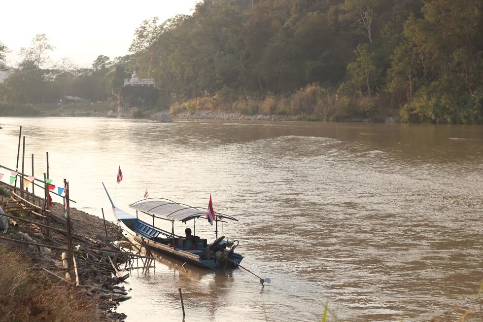
Mekong - Childhood Memories and Riverbank Transformation
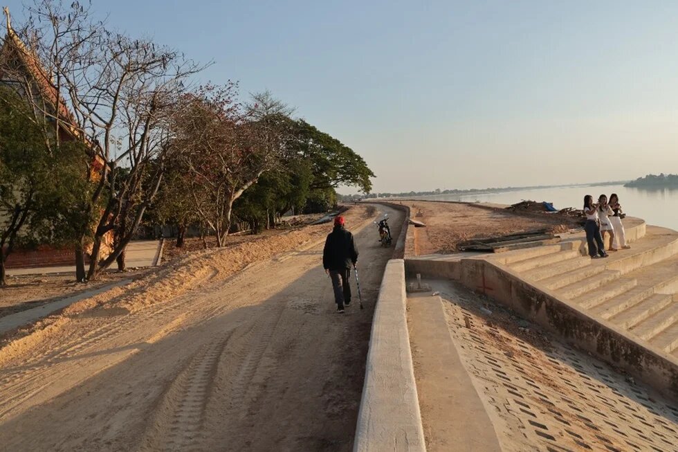
Name of river: The Mekong River, Vientiane, Laos
Photo taken: January 2026
Contributor: Sopavanh Rassapong
I grew up along a green and living Mekong Riverbank where nature shaped every part of my childhood. The river beside our village temple in Vientiane was lined with soft grass, seasonal vegetables, and shady trees. Families tended small gardens, fishermen cast their nets in the early morning light, and we children played endlessly along the water. It was a place of laughter, imagination, and learning — where I felt the river breeze while reading aloud with friends or running freely on the sandy paths that once followed the river’s natural curves.
Today the riverbank tells a different story. The embankment now stands where gardens once flourished, built to protect communities from the rising flood risks brought by climate change and upstream hydropower operations. While I understand the need for safety, I feel the absence of the green spaces that once held my childhood memories. The engineered steps, bare soil, and newly formed paths show progress, yet they remind me of what has quietly disappeared.
Still, the Mekong remains the heart of our life. I hope that as development continues, we find ways to restore greenery, reduce littering, and nurture a healthier river for future generations.
Irrawaddy – The River that Carries Life, Suffocating by Pollution
Name of river: Irrawaddy (taken from Minbu riverside), Minbu, Myanmar
Photo taken: January 2026
Contributor: Treasure
The Irrawaddy River has been part of every stage of my life. I have lived in three towns beside it — Pakokku, Nyaung-Oo, and Minbu — and each place gave me different experiences and relationships with the river. When I was in primary school in Pakokku, my father took us to the sandbanks on summer evenings to play and picnic. I loved watching tadpoles swim in the crystal-clear water. At that time, the river was a place of simple happiness for me.
In Grade 8, I moved to Nyaung-Oo, which is connected to Pakokku by a bridge. As a teenager I saw another side of the river: floods sometimes swamped streets and wards near the water, and people relied heavily on river water for bathing, cooking, and even drinking. In summer water shortages were common, and families often had to buy water to survive.
For the past three years I have lived in Minbu, with my house right beside the Irrawaddy. I see the river every day and watch how it changes with the seasons. Floods have become more severe each rainy season, while in summer the river’s width shrinks year by year. Local people worry about these changes. A wet market near the river means plastic and other waste are dumped directly into the water, which has created massive trash piles. It is very different from the river I remembered in Pakokku: tadpoles no longer swim in crystal-clear water; sometimes I find them among floating trash. Today the river faces increasing floods in the rainy season, lower water levels in summer, and growing pollution that threatens the lives that depend on it.
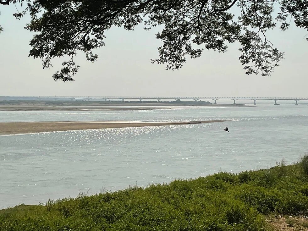
Pai & Nam Pan - Where My Rivers Still Flow, From Home to Exile
Name of river: Pai River, Mae Hong Son, Thailand (shared here because its landscape and spirit remind me of my childhood river, Nam Pan, which I cannot currently access.)
Photo taken: January 2026
Contributor: Nang Shining
I grew up beside the Nam Pan stream, a tributary of the Salween River, in Mong Pan, Shan State, Myanmar. Nam Pan begins in the Loi Lin Morn Mountain range, formed by many small creeks before flowing into the Nam Taeng and then the Salween. Mong Pan takes its name from Nam Pan, “mong” meaning town, “nam” meaning water, and “pan” meaning to circle or moving around, like a river embracing the life of the town. Nam Pan was our source of food and livelihood. Its water nourished garlic, rice, and soybeans. As a child, I learned to swim in the river and ran barefoot through green paddy fields. Small streams flowed behind our home. In the evenings, mothers, aunts, and neighbors gathered to wash clothes, sharing stories and laughter, while my cousins and I splashed nearby until our lips turned blue.
Today, those small streams disappeared, blocked by authorities. The Nam Pan also weakened, dried by deforestation. In early 2026, standing by the Pai River in Mae Hong Son, Thailand, its clear water and green fields brought my childhood back. Though different rivers, they share the same destination, the Salween, where my past and present flow together, toward a free and living river.
I was born and raised in Mong Pan, where my childhood was shaped and embraced by the Nam Pan River and work focuses on conserving the Salween’s ecology. Due to the ongoing civil war, I remain far away from my homeland.
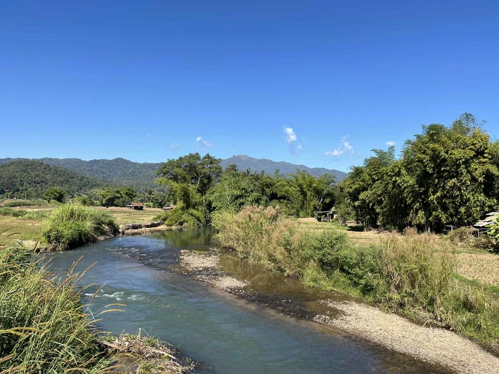
Huai Sang Khiap - The Stream of Subsistence Livelihoods Becoming a Scarce Resource
Name of stream: Huai Sang Khiap, Kalasin, Thailand
Photo taken: July 2025
Contributor: Tipakson Manpati
Huai Sang Khiap is a tributary of the Lam Pao River in Kalasin Province in northeast Thailand. Glutinous rice paddies line both banks and are usually planted once a year. The stream was our childhood playground — we learned to swim and played on the sandbanks that emerge in the dry season — and it has long been a food source for villagers, who catch fish and other aquatic animals to provide subsistence for their families. Wild trees and edible plants along the stream offer additional resources, notably bamboo used to build and repair traditional footbridges and fishing gear, and bamboo shoots used in local cooking.
Nowadays, intensified use of the stream for off‑season rice cultivation and other cash crops, without proper water management, has reduced water availability for farming and made resources such as wild bamboo less plentiful as soils dry out and evaporate more quickly during frequent heat waves. Extreme and erratic climate patterns — prolonged droughts, delayed or reduced rains, and occasional heavy downpours — have further stressed the stream ecosystem and disrupted the cycle of natural resources.
About five kilometers upstream in Ban Sung Noen village a sluice gate was built. Although intended to store water during scarcity, the structure has altered the stream’s natural flow, and some villagers upstream and downstream complain they lack access to proper water management; many also report it has become harder to find fish and other aquatic life.
Kok – Rare Earth Demands, Toxins in the River
Name of River: Kok River, Chiang Rai, Thailand
Photo taken: January 2026
Contributor: Tananan Jaisawang
The Kok River has been part of my life in Chiang Rai for as long as I can remember. It is the quiet heartbeat of the town, connecting people through everyday life and seasonal traditions. Growing up, the river was a sanctuary where we gathered. For me, it was never just a river, but a symbol of growing together with the people and the place we call home.
Today, the river’s role has shifted. While the flow appears as usual, it hides an invisible threat. Contaminants like arsenic and heavy metals are leached from unregulated gold and rare-earth mining activities upstream in Myanmar. These pollutants flow into the Kok River, creating widespread impacts across multiple dimensions. These invisible toxins silently accumulate within our ecosystem, seeping into the soil and crops that feed us all. It has become a hidden chain of contamination in our food system.
To me, the river is sending a powerful signal. Its condition reflects the fragility of a shared health that connects us all. Paying attention to these subtle signs matters, so the river may remain a living presence, rather than something that simply passes by, untouched and unseen.
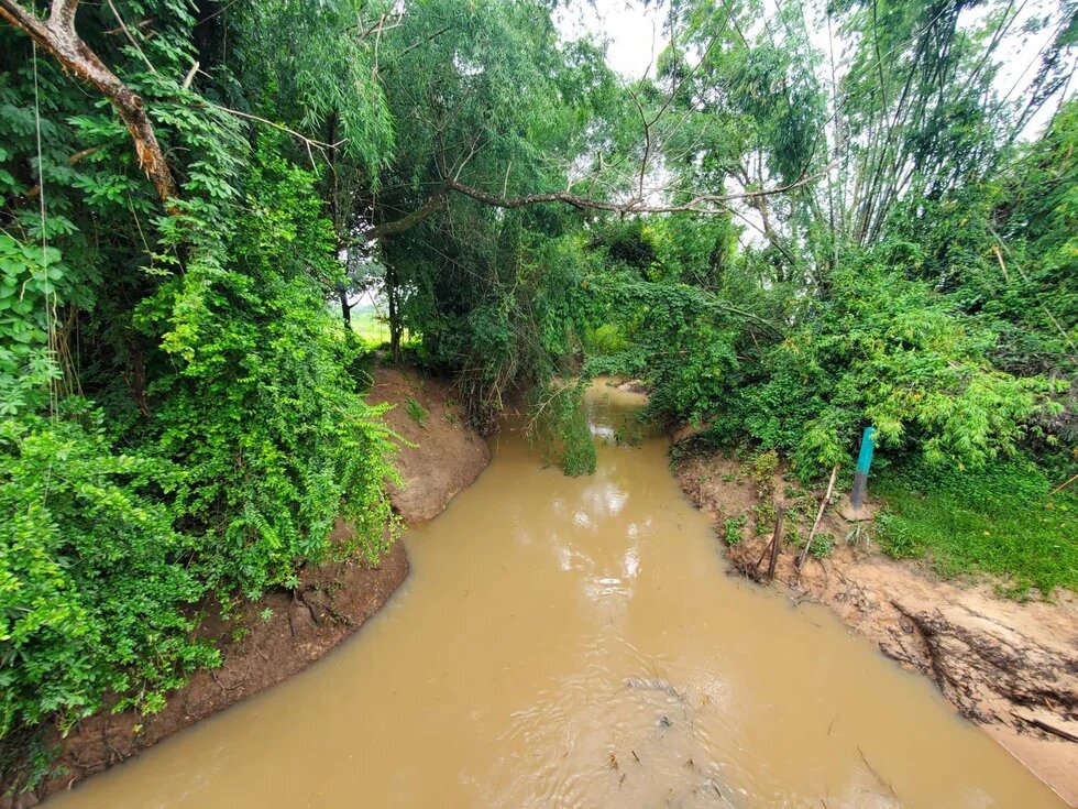
Cai, Cu Giang or Phu Loc – Villagers’ Traditional Ways of Life Reversed into Vulnerability
Name of river: Cai River, Cu Giang, or Phu Loc River, Khanh Hoa province, Vietnam
Photo taken: August 2025
Contributor: Hoang Duong
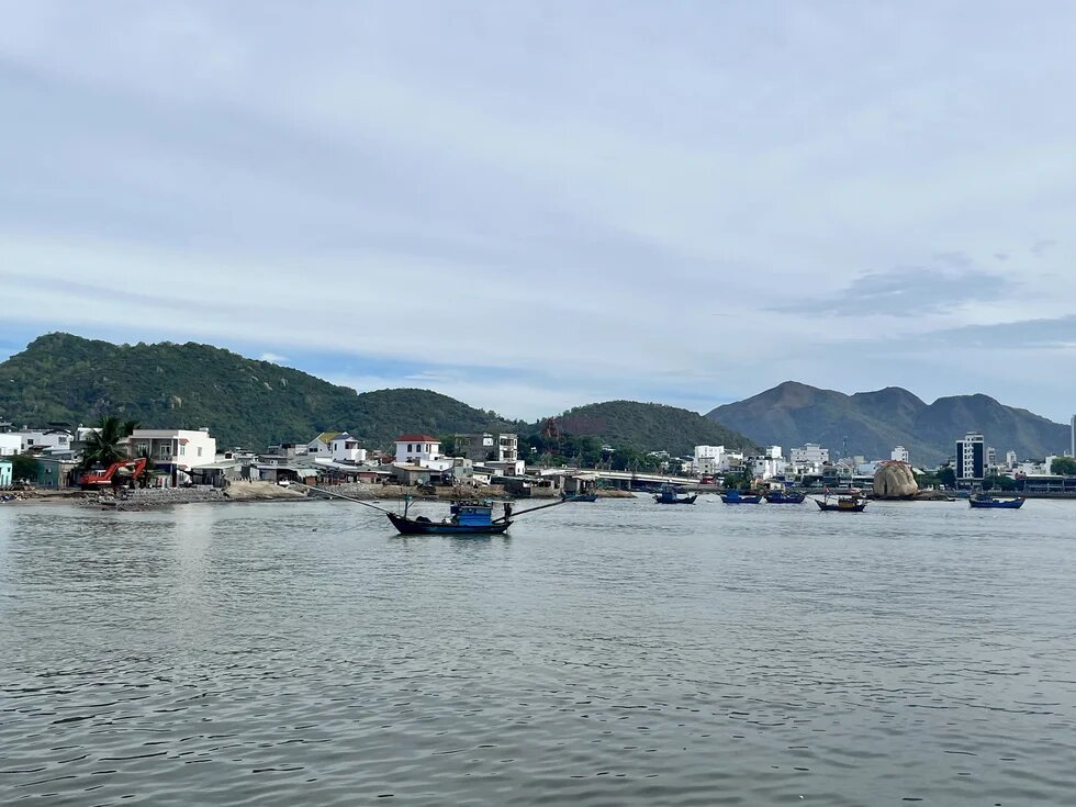
The most well-known name of this river is Song Cai (Cai River). The picture is taken at the river mouth, where the Cai River meets the ocean in Nha Trang City. It is the source of life for people living along the riverbanks, providing water supply, irrigation, and helping to reduce the worst impacts of flooding. For me, the river connects me to the surrounding nature. Each year, when the water turns a reddish, muddy color from suspended sediment, I know the rainy season has begun. Rain pouring from the mountains is carried to the river and then to the ocean, which helps lower flood risk for Nha Trang city. I was never allowed to swim in the Cai River because the current is strong toward the ocean, but during floods my friends and I still enjoyed playing in the water and catching small fish that washed into our houses.
Recently, the Cai River and its tributaries around Nha Trang have been reinforced with more dykes to reduce annual flooding. Longtime residents of the river’s small islands—fishing and worker communities—were relocated to make way for real estate and infrastructure projects. Those who remain face severe erosion caused by sea level rise. In the picture you can see a mix of old and new houses and a red bulldozer. If you look closer, there is a statue of Avalokiteśvara (the lord who looks upon the world with compassion) on the island, where fishermen come to pray for protection before sailing to the ocean.
Can Tho & Hau - The Last Round of Fishing and One of the Last Fishing Boats in the Village
Name of river: Can Tho River (one of the Hau River’s tributaries), Can Tho, Vietnam
Photo taken: February 2026
Contributor: Doan Minh Sang
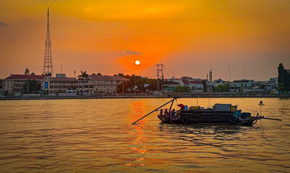
The river of my childhood was never merely a ribbon of water passing through the village, it was a quiet lifeline sustaining every home. Its waters served daily living, its sediment enriched the fields, and the small boats carrying crops and fish gently traced pathways of livelihood and connection. Along that riverside, we grew up with the sound of oars touching water, with afternoons scented by young mud and wind.
Today, the river appears clearer, yet its former soul seems diminished. Sediment has grown scarce, and the fishing and agricultural cargo boats have largely vanished, replaced by sand-mining vessels and tourist craft. This transformation reflects the rhythm of development, but it fades the memory of a life once inseparable from the water.
The river still flows; only its story is quietly changing. I wonder—does this mark the inevitable truth of progress, or the gradual fading of a cultural identity shaped across generations?
Mahakam – Kalimantan’s Longest, Most Abundant River Facing Ecological Threats from Coal Mining
Name of river: Mahakam, Kalimantan, Indonesia
Photo taken: July 2025
Contributor: Maulana Yudhistira
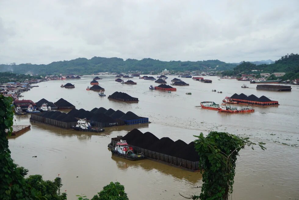
The Mahakam River, one of the longest rivers in Kalimantan, is home to the ancient Hindu Kingdom of Kutai, one of Indonesia's oldest kingdoms. Historically, the river has been a vital lifeline for local communities, providing clean water and abundant fish for consumption. It is also the habitat of the endangered Mahakam freshwater dolphin, known as the Pesut. Once a shared living space and a source of essential resources for basic needs, the Mahakam River has increasingly shifted to serve the interests of extractive industries, including deforestation and coal mining. Today, it is a bustling thoroughfare, with 70-75 coal-laden pontoon boats passing daily, transporting East Kalimantan's natural wealth—resources that will never be replenished, leaving behind the looming threat of ecological disaster.
__
Disclaimer: This published work was prepared with the support of the Heinrich Böll Stiftung. The views and analysis contained in the work are those of the author and do not necessarily represent the views of the foundation. The author is responsible for any liability claims against copyright breaches of graphics, photograph, images, audio, and text used.


